Sarvabad and howraman
Sarvabad
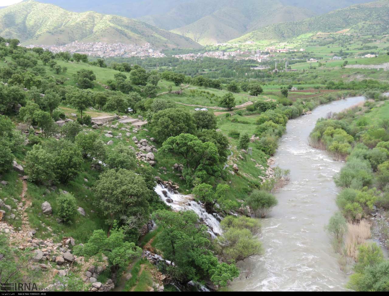
Sarvabad is one of the cities of Kurdistan province, which is located at a distance of about 90 kilometers from Sanandaj, the capital of the province. A large part of Oramanat(Howraman) region, which is one of the most attractive regions of Kurdistan province, is in this city.
Sarvabad city was formed in 2013 and before that it was one of the districts of Marivan city. Currently, this city consists of two cities and eight villages and has a population of 66,709 people.
The weather of different parts of Sarvabad city is different due to the changes in altitude and varies from mountainous and cold areas to areas with almost moderate climate.
Horamanat region includes parts of Sanandaj, Kamiyaran and Sarvabad . The mountainous nature, the forest cover and the passage of the river along with the stepped architecture of Horamanat villages, has turned this area into one of the most beautiful parts of Kurdistan province, which attracts many tourists.
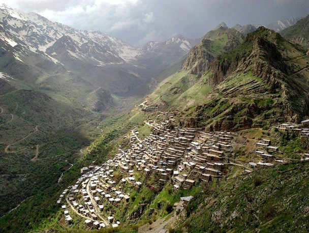
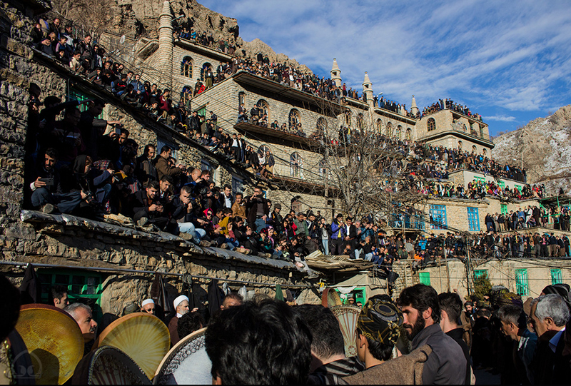
Sirvan River, which is one of the important rivers of this region, passes through Oraman region. Sirvan is the longest river in Kurdistan province, which eventually enters the country of Iraq and flows into the great Tigris river. In addition, most of the high peaks above three thousand meters of the province are also in Oraman region.Oraman Takht city is one of the most beautiful villages in Horaman region. Horaman people believe that this village was once the center of government and the capital of local rulers and the word Takht means capital. The staircase architecture and the historical context of Oraman Takht and the surrounding nature are the most important features of this village.
The annual wedding ceremony of Pir Shaliar is one of the most important rituals of Horaman Takht people, which is held every year approximately 45 days after the beginning of the winter season and at the same time as the Sedeh festival. On the 45th day of spring, a ceremony called Kumsai is held in Pir Shaliar's grave.
The green and mountainous villages of Dezli and Darake are among the other beautiful villages of this region. This area is one of the main resorts for local people and tourists. There are many other beautiful villages in this area that are worth visiting.
Bel mineral spring is one of the other tourist attractions of Sarvabad , which is located on the border of Kurdistan and Kermanshah provinces. This spring is located between the two villages of Nav in Kurdistan province and Hajij in Kermanshah province.
The people of Oraman region produce remarkable handicrafts, among which we can mention Julai (traditional textile), Kalash embroidery and woodwork.
Click here to go to Sarvabad
The attractions of Sarvabad
Kani Qol
Kani Qol is the name of a spring at the foot of Kosalan mountain between Durood and Razab villages of Sarvabad in Kurdistan province. This spring is one of the interesting geological phenomena that is filled with water due to the melting of the snow in the heights of Kosalan in the spring season.
Click here to go to Kani Qol
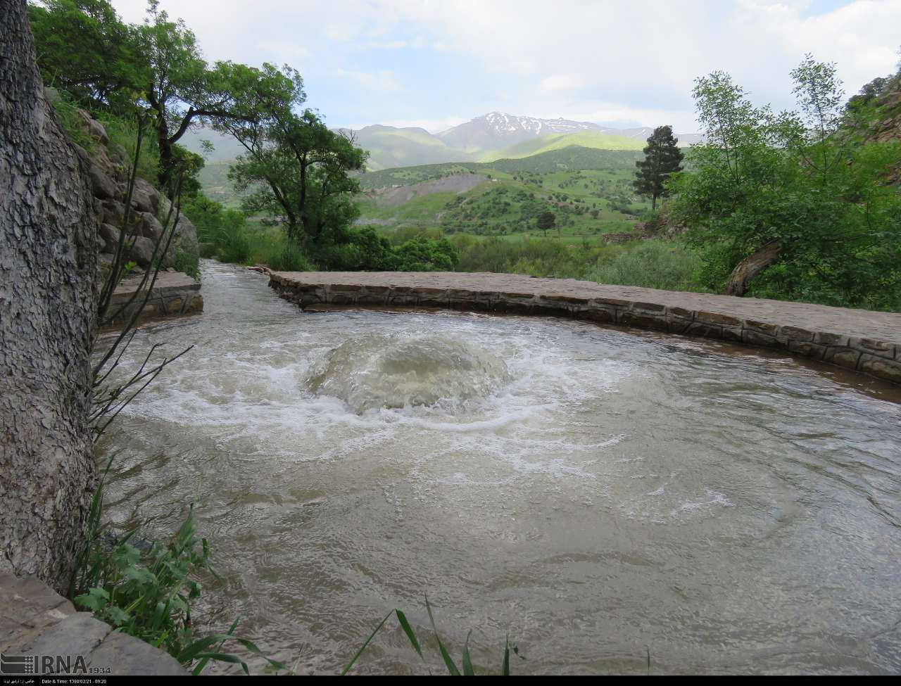
Dezli village
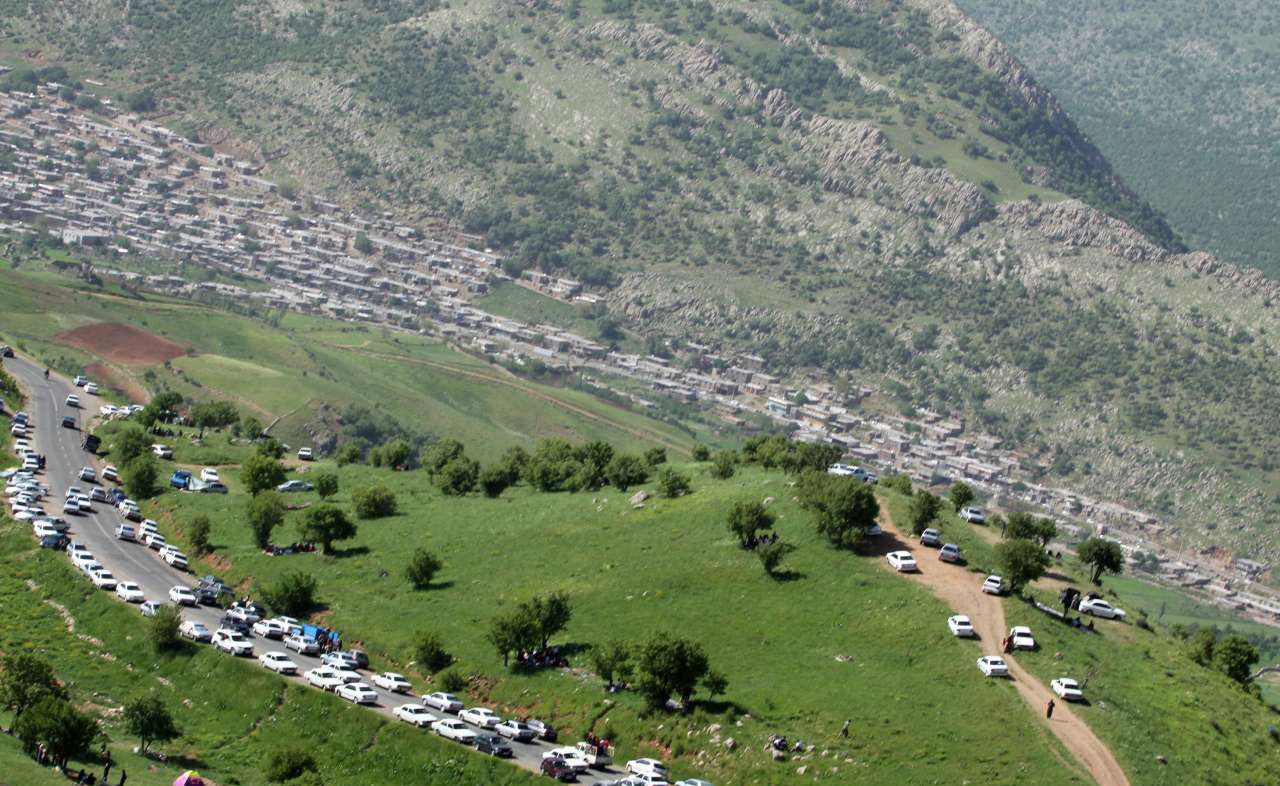
Dezli village is one of Sarvabad districts in Kurdistan province. It is 115 km away from Sanandaj. Dezli can be considered as the gateway to the pristine and spectacular nature of the Howraman region, especially when you come across a gate of huge rocks on both sides of the road. The village is bigger than other nearby villages and in terms of tourism, it is in a better but not quite good condition. The nature of the village is amazing, especially in the spring season, when you can see the greenery, bubbling springs, and colorful flowers as far as the eye can see. Dezli is located between the mountains of Delmarz, , Dalani and Kamanjeh, and this has caused many mountaineers to come to this village from nearby cities. There are some ancient hills in the village, which are unfortunately not registered, and there are no signposts or information about them. On Fridays in the spring season, there are local music festivals in Dezli, which are organized by the people themselves, and seeing hundreds of people in colorful Kurdish clothes creates a very good atmosphere. Every year, at the same time as the Pirshalyar ceremony, a festival called "Youth and Nature" is also held in Dezli. Small restaurants that only serve kebabs are not rare in Dezli. Be sure to try the delicious "Kalaneh" of Dezli and strawberries.
Click here for directions to Dezli village
Darake village
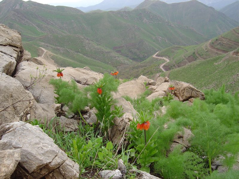
Darake village is one of the functions of Sarvabad city of Kurdistan province and is located 50 kilometers south of Sarvabad. Darake village is located in a mountainous area and its height is about 1700 meters above sea level. This village has a Mediterranean climate with mild and pleasant weather in spring, relatively hot weather in summer, cold weather in autumn and very cold weather in winter.
Due to its special location, the village of Darake has a beautiful and unique effect. Its beautiful views are attractive and interesting in most seasons Seko mountains in the north and Dalani mountains and Kamanjar is located in the south and in front of the village, which has given a special beauty to the village and even the region. The natural attractions of the village are the Wazn (Selur) waterfall, the beautiful area of QaLa Khani, Selor and Hazarani gardens, etc. make .
Click here for directions and to go to the village of Darake
Horaman Takht city
History of Horamanat village
According to the remaining documents, people lived near the villages of Nav, Hajj and Asparez, whose history is estimated to be around 40,000 years and they were in the Paleolithic era. From this historical period, the tools of the cavemen, the remains of the stove and some bones that are similar to the skeleton of an antelope were found in the caves of Mero and Gilan. Also, the bones of Neanderthal humans have been discovered in Shanider and Biston caves, which are said to be more than 40,000 years old. Over time, people migrated to this village, whose remains were found in a cave called Kanache.
It is interesting to know that the researchers have found evidence around the village of Roar, including a large stone grave with a dome-shaped roof and a number of houses, which show that people lived in the area during the Iron Age, and their history is estimated to be more than 3000 thousand years. . These findings are considered to be the most historical works of this region and its architecture is related to the western region of Zagros. Because its design and construction is in the shape of a Chinese land, and an inscription was found near the village of Tangivar, which seems to have been remembered from the Assyrian era. Images of the Assyrian ruler named "Sargon II" are engraved on this inscription, and also a cuneiform inscription was found which, after its translation by experts, mentions the Assyrian ruler's attacks on the Oraman and Zagros regions.
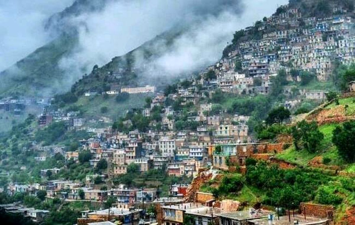
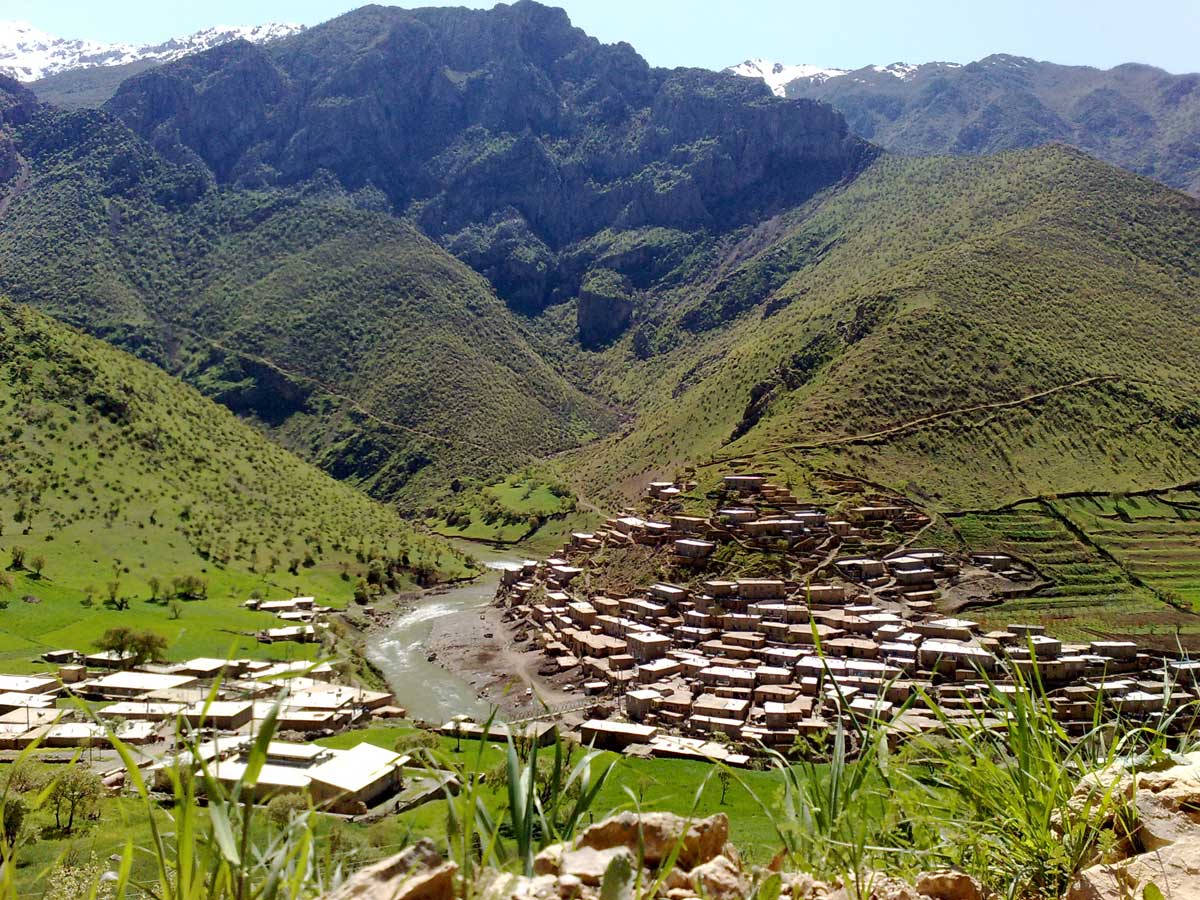
The stepped architecture of Oraman Takht and its spectacular houses has shaped the village into a pyramid, which is topped by an ancient castle. The stepped architecture of these houses has made it famous as the village of Hazar Masoleh, and it is in such a way that the yard of each house is the roof of another house. Oramanat's architecture and the greenery of this dreamy mountain area, as if it depicts stairs to heaven.
Pir Shaliar's ceremony is held in Huraman (Oraman Takht) village of Kurdistan every year in the middle of winter and the wedding of "Pir Shaliar" is celebrated in three days. The tomb of Pir Shaliar, who was a disciple of Sheikh Abdul Qadir Gilani, is located at the end of the paved road in Oraman. This ceremony includes slaughtering the sacrificial animal, beating the tambourine, eating special food, and spending the night, saying Tahlil and praying (Zekr).
Click here for directions and to go to Oraman Takht city
Click here for directions and to go to Pirshalyar Temple
Belbar village
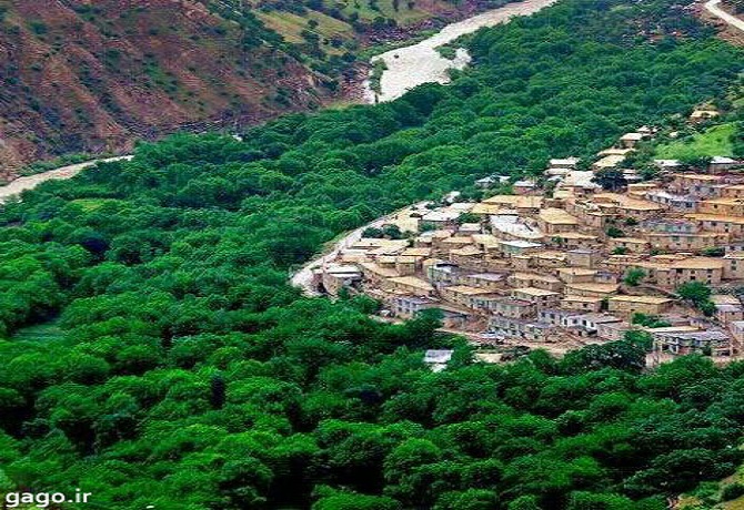
This village is located at an altitude of 900 meters above sea level. Sirvan river flows next to it and it is the only village whose scenery remains natural and pristine. In addition to Sirvan, this village also has temporary seasonal springs called Belchmi, which amaze the eyes of every viewer, and it is the only spring in Iran that erupts ten meters long. But unfortunately, these springs have been made ugly by building several artificial places. This village has three villas named (Dereh Vian-Shireh Dereh-Oudalan). The people of the village are at a high level in terms of science and culture, and it has the largest number of students in the region. This village has three mosques, two schools, communication and internet network. There is also a non-governmental organization in this village called Trifa Horaman Association.
Click here for directions and to go to Belbar village
Selen village
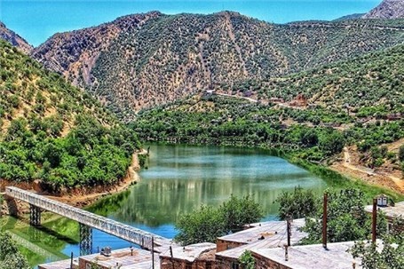
This village is located on the most important nature tourism route of the province, which is the route from Marivan to Horaman Takht and Hajij tourist village, and this is one of the advantages of the village tourism in planning tourist tours, and due to its location in the protected area of Kosalan, it has a variety of species. It has animal and plant life and this diversity has greatly contributed to the development of ecotourism in the region. Due to the construction of Darian Dam in recent years, the water of the lake behind the dam has covered part of the village's land, and for this reason Selin village is the last village where Through the boat, transportation to other villages such as Hajij is done, which usually this type of transportation is used in the program of travel tours in combination with land trips.
The attractions of Selin village are as follows:
Shahu Heights
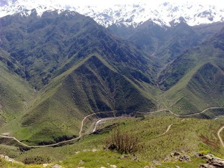
Shahu Heights is the name of a part of the Zagros mountain range that is located along Selin village. The access path to these heights is long and with a steep slope and is not suitable for children or the elderly. In a part of the route you have to pass through the heart of the forest. The clouds are near you and the singing of the birds invites you to continue on the path. This path is completely covered with nature's art and the further you go, the more attractive views you will see.
Sirvan River
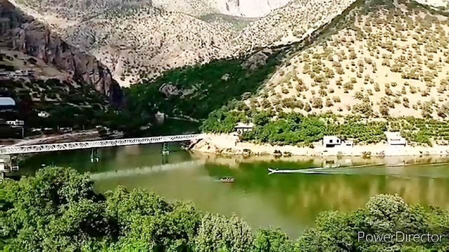
Sirvan river passes through a winding path from the heart of Zagros to Selin village and is the lifeblood of this green area. On the way of the river, everywhere you look, you will encounter freshness and greenery. The flow of this river is so strong and powerful that they
built daryan Dam on it.
If you are looking for a stunning view in Selin village, be sure to visit the bridge that is located on the Sirvan river. The narrow width of this bridge allows only one vehicle to pass at a time. The beauty of this bridge is revealed only when you reach the halfway point. A stunning view on one of the biggest rivers of Kurdistan province awaits you.
Selen Castle
Since, according to historical evidence, Selin village is more than 900 years old, many archaeologists hoped that a historical discovery would be made in this area. Many excavations were done until recently they managed to discover a historical castle 1.5 km south of Selin. Even though there are not many remains of this fort, scientists believe that it dates back to the post-Islamic period and estimates that it is more than 1000 years old.
Click here for directions and to go to Selin village
Bel spring
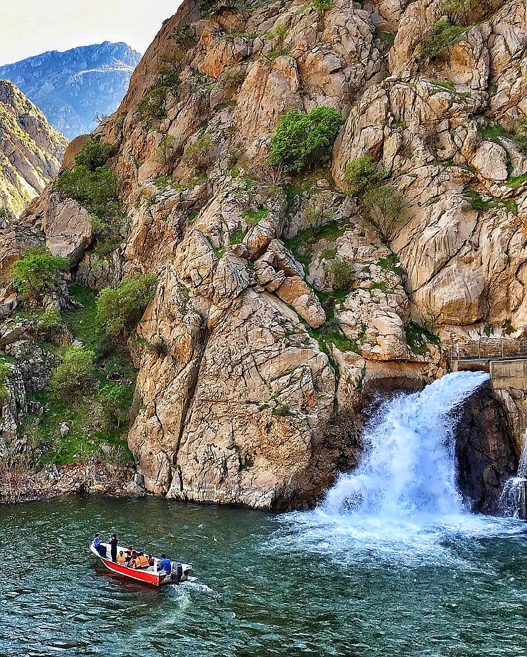
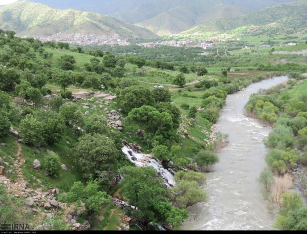
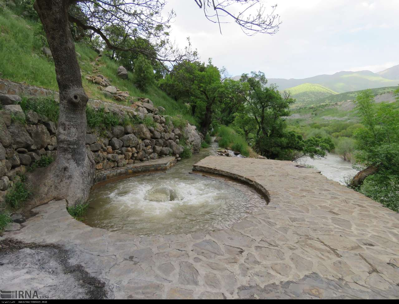
Bel spring is one of the amazing attractions of Iran, which is located in Oramanat region of Kurdistan. Kani Bel Spring, which has an amazing volume of water, is located near the village of Nav and Hajij and flows into the Sirvan River. This spring is fed from the heights of Takht Mountain and is very loud. Cheshme and Bel River are known as "the shortest river in the world" with a length of 15 meters. This spring, which is known locally and in the Kurdish language as Kani Bel and probably got its name from the ancient Babylonian water god whose name was Bel, is located two kilometers from Hajij and at a short distance from the Sirvan river, and its water after leaving From the heart of the mountain, a roaring waterfall forms and flows into the river.
Click here for directions and go to bel spring
Dewaznaw village

It is located in the southwest of Kurdistan province and in Oramanat area of Sarvabad city, 45 km from the center of this city.
This village is located between the Sirvan River and Shahu Mountain. After passing through difficult roads on the slopes of the Shahu Mountains, we reach this village, a village that is thousands of years old.
The presence of numerous waterfalls, greenness and virgin nature of that area has turned this village into a tourist village.
Dewaznaw means the birthplace of water. If you go to the village at the end of winter and early spring, all the water flows out from under the houses and alleys. The height of the village is about 940 meters above sea level, and due to the presence of a high peak and the tropical nature of this area, the people of this village experience a pale autumn.
It is one of the terraced and tourist-friendly villages of the province, which has a lot to say in the fields of handicrafts, agricultural tourism and sports tourism. Purple weaving handicrafts are unique to this village, which Diuznav was nationally registered as a purple weaving village in 2019.
Another industry of this village is fish farming, which is flourishing due to the sources of running and clean water, and dozens of fish farming units have been established in this village.
The flow of life in this village is not spent only doing daily tasks. The people of this village in the bottom of this valley even cultivate their sports talents.
The presence of a football field and the excitement of playing in it has shown a different effect from the tourist attractions of this village.
The most obvious feature of Diuznav is the Kurdish Nowruz event. This region experiences spring earlier than other regions, and because the weather warms up earlier in this village, in the past, the beginning of the spring season was placed on the first of March, and Nowruz was celebrated at that time of the year, which is known as Kurdish Nowruz.
Click here for directions and go to dewaznaw village
Besaran village

Click here for directions and go to besaran village
Dalamarz village
Click here for directions and go to Dalamarz village
